GPS Area Mapping
Systems integration approach to grant writing. We combine professional grant development with working software examples and technical tools that can enhance federal applications and simplify administration.
GPS Area Mapping

Professional GPS mapping interface for municipal documentation and federal compliance
Working Software Example
View actual GPS mapping application we've developed:
This type of working system can be integrated into grant applications to demonstrate technical feasibility and implementation readiness.
View Live ExampleTry It Yourself
Test the GPS area mapping application on your mobile device
Access Mobile App✓ iPhone Compatible | Android Coming Soon
Enhanced Grant Applications with Working Tools
This GPS mapping application was originally proposed as part of our USDA rain garden grant - a community tool for documenting rain garden locations. We've since expanded it into a general-purpose area mapping tool that organizations can use for any physical area documentation needs.
While not survey-grade precision, GPS mapping is often sufficient for grant applications, project documentation, and federal compliance requirements.
Beyond Grant Writing: When grant applications can be strengthened with working tools, custom dashboards, or technical demonstrations, we can develop these enhancements. Each project is evaluated individually - some benefit from technical additions, others don't need them.
Systems Integration Capabilities
Examples of technical tools that can enhance grant applications and simplify federal compliance
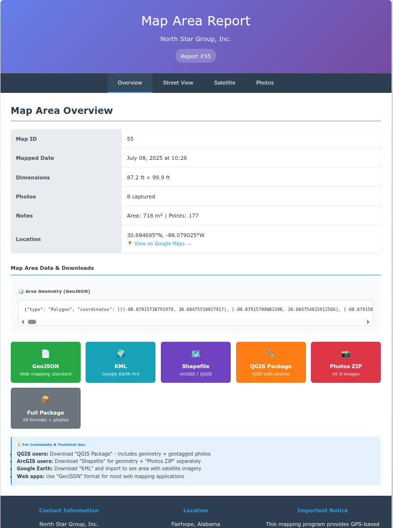
Project Overview Report
Complete documentation with GPS coordinates, area calculations, and metadata for federal compliance requirements.
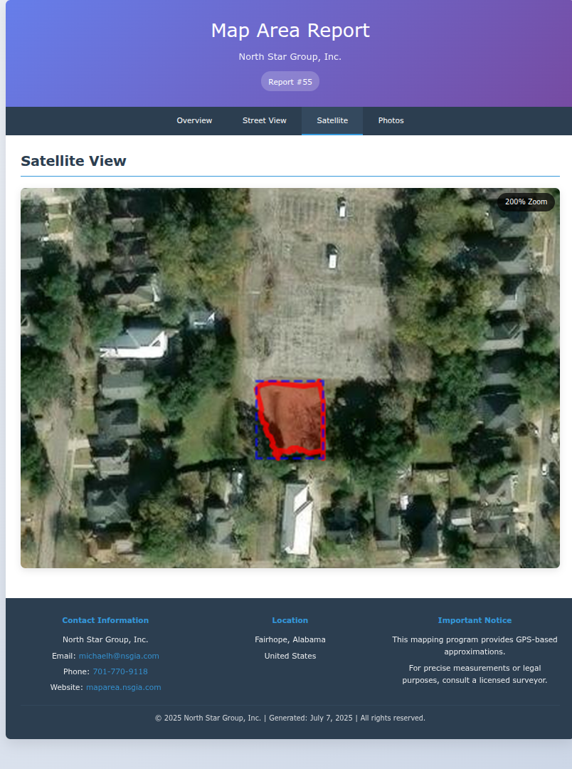
Satellite Documentation
High-resolution satellite imagery with precise boundary mapping for visual verification of project scope.

Photo Documentation
Geotagged photographs with timestamps and coordinates for comprehensive site verification.
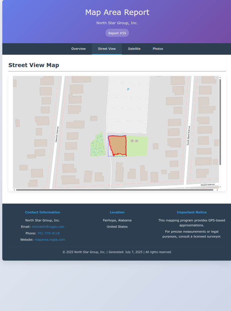
Street-Level Documentation
Detailed mapping interface for precise boundary definition and contextual site information.
Technical Capabilities
Federal Compliance
Generates documentation in formats required by federal agencies: GeoJSON, KML, QGIS packages, and PDF reports.
GPS Accuracy
Sub-meter accuracy for precise boundary documentation and area calculations meeting federal standards.
Mobile Ready
Works on smartphones and tablets for field documentation by municipal staff and contractors.
Secure Access
Authentication and audit trails for municipal security requirements and grant compliance.
Integration and Implementation Support
We bring a developer mindset to grant writing - creating working examples, dashboards, and technical tools that strengthen applications and simplify administration. Custom integration services available based on project requirements.
Schedule Consultation View Grant Success Example